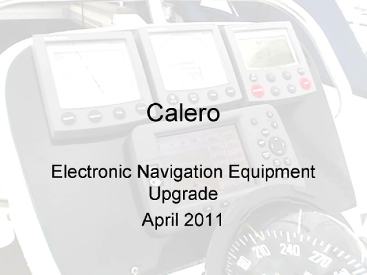

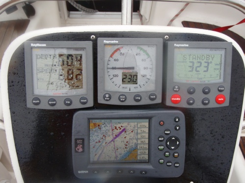
Navigation Aids
Since we purchased Calero in 2006 we have upgraded the electronics to incorporate a coloured chart Plotter with AIS and Radar. A key requirement was to have a chartplotter at the binnacle and at the chart table. The binnacle footprint was key as we wished to fit the plotter on the binnacle within the existing space. Garmin kit met this requirement and in addition could display AIS targets. Garmin had also just introduced their new GMR18 radar. Raymarine had similar kit available (the E Series) but although this could provide much of the required functionality it was impossible to fit into the required footprint at the binnacle.
The choice of Garmin presented a number of challenges not least to connect the Raymarine sensors and autopilot to the Garmin plotters and radar. This was facilitated by the use of Actisense NMEA interface boxes.
The following slides represent the configuration as it stands today. These are working documents. If you would like further clarification on how this works please contact me.
User Manuals and Service Documentation can be found here
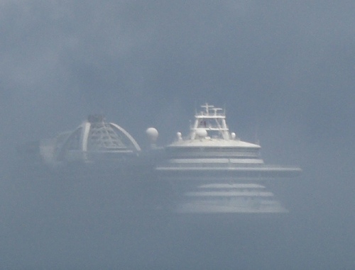
The configuration works well and has been tested under extreme conditions both in heavy commercial traffic and in very poor visibility. The following pictures were taken in the Straits of Dover in the Summer of 2008.
And the following off St Peter Port in the Channel Islands in 2009.
Further minor improvements are planned to address some, non critical, issues:
(1) Navtex. The NASA PC Navtex PRO Receiver does not seem to pick up the relevant Navtex transmissions. This may be due to the location of the aerial on the pushpit rail or simply that Navtex is notoriously difficult to receive in harbour. It is proposed to mount the aerial above the GMR18 radar dome.
(2) RN300 (RayNav 300). The old Raymarine plotter has been retained to provide relay of all Raymarine information on the Seatalk bus, e.g depth, wind data and rudder position, at the nav table. It is also used to provide a clear GPS position which can be read by a VHF operator. There is a known problem with the RN300 in that occasionally it loses its Fix. This is not critical as all other equipment including the GMDSS VHF radio still receive the GPS information. It is however inconvenient. It has been suggested that this may be a voltage problem and the problem might go away if the RN300 power supply is increased to 24 volts DC.
(3) Position Log. Should there be a power failure it would be convenient to have a log of the boat’s position e.g. On paper which can be used for emergency navigation. There are some quite pricey instruments which can provide this. There are also a number of devices. Not least hand held GPS devices which can provide this information. Further investigation is required of the available options.
(4) Active AIS. There is an active debate as to whether recreational craft should carry AIS Class B Transceivers which would allow Calero to transmit its own vessel information to other AIS receivers.. From my experience it would be desirable to carry Class B when sailing long passages which pass through or close to commercial shipping lanes. Further investigation is required of the available options.